2.7 KiB
orx-kdtree
Fast search of points closest to the queried point in a data set. 2D, 3D and 4D.
Demos
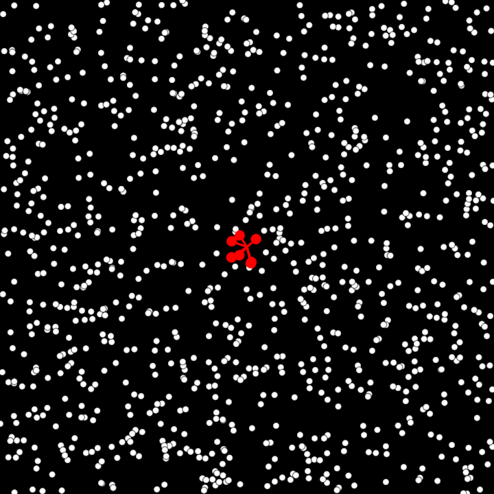
DemoKNearestNeighbour01
This demo initializes an interactive graphical application where 1000 randomly distributed points are displayed on a 2D canvas. A KD-tree structure is used for spatial querying of the points, enabling efficient nearest-neighbor searches based on the user's cursor position. The closest 7 points to the cursor are highlighted with circles and lines connecting them to the cursor.
Key features:
- Generates 1000 random 2D points within the canvas.
- Builds a KD-tree from the list of points for optimized spatial querying.
- Visualizes the points and highlights the 7 nearest neighbors to the user's cursor position dynamically.
- Highlights include red-colored circles around the nearest points and red lines connecting them to the cursor.
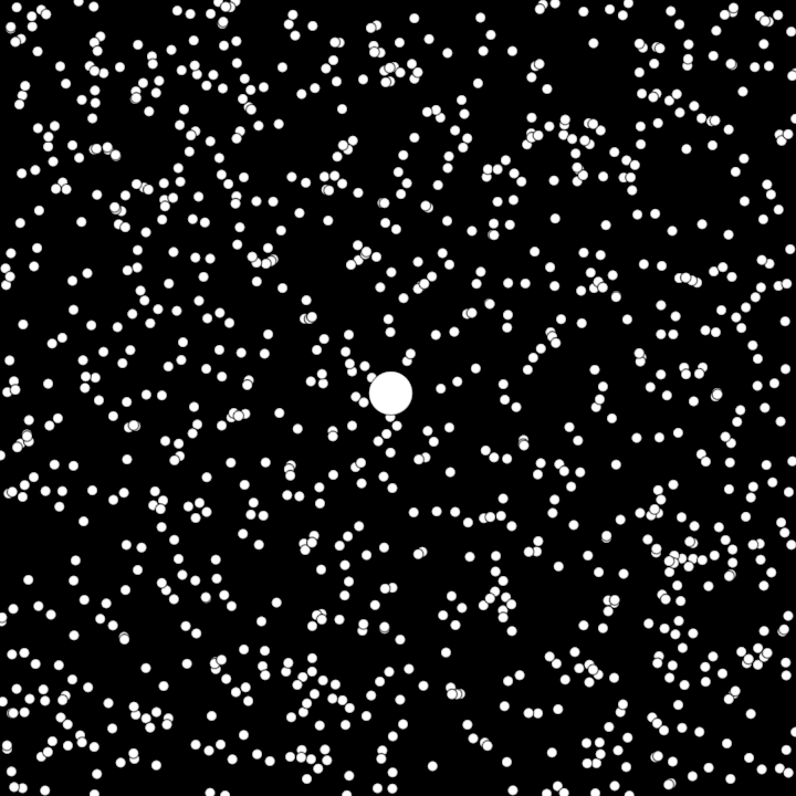
DemoNearestNeighbour01
Initializes an interactive graphical application that displays 1000 randomly distributed 2D points. The points are organized into a KD-tree for efficient spatial querying.
Key functionality:
- Displays the points as small circles on the canvas.
- Dynamically highlights the nearest point to the cursor's position by drawing a larger circle around it.
Highlights:
- KD-tree structure enables efficient nearest-neighbor searches.
- The nearest point to the cursor is determined and visually emphasized in real-time as the cursor moves.
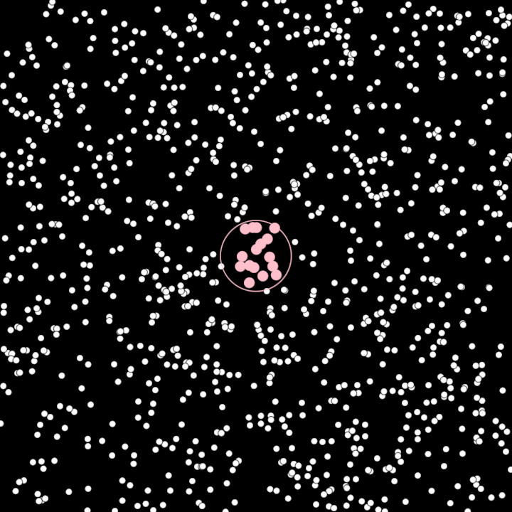
DemoRangeQuery01
Initializes an interactive graphical application that demonstrates spatial querying with KD-trees. A canvas is populated with 1000 randomly distributed 2D points, and a KD-tree is used for efficient spatial operations. The program dynamically highlights points within a specified radius from the user's cursor position.
Key features:
- Generates and displays 1000 random 2D points within the canvas.
- Builds a KD-tree structure for optimized querying of spatial data.
- Dynamically highlights points within a specified radius (50.0) from the cursor position.
- Visualizes the current query radius around the cursor as an outline circle.
- Uses different fill and stroke styles to distinguish highlighted points and query visuals.